
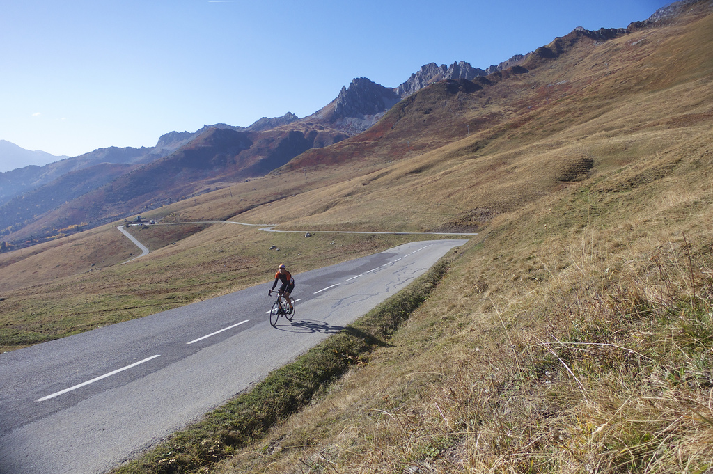
I cycled the north side of Col de la Madeleine the other day with my friend Philippe. I thought I’d post here details on all four ways to climb this majestic, monster col. Each option includes more than 1500 metres of ascent! Three of the routes are paved, the fourth visits the amazing Lacets de Montvernier & Col du Chaussy, before taking a fabulous unpaved road.
Madeleine is one of only two roads that crosses the Vanoise Alps (the other is Col de l’Iseran far to the east). Until the 18th century it was known as Col de la Colombe, but was renamed after a little 18th century chapel dedicated to St Madeleine.
https://www.cycling-challenge.com/wp-content/uploads/madn75.png
The North Side
The yellow route on the map
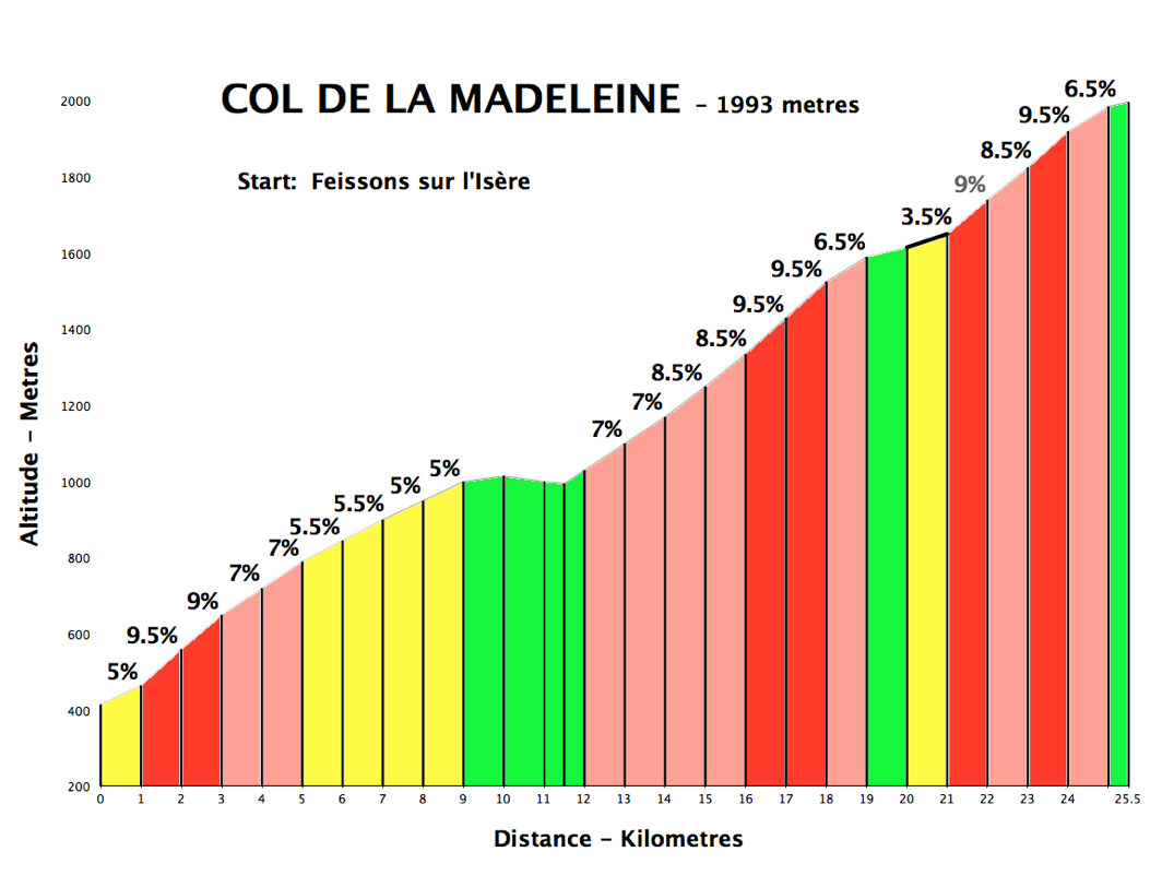
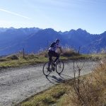
At 25 kilometres, the north side is 6 kilometres longer than the classic south side. As the profile shows, there are a few easy kilometres along the way. But it’s still hard work. I prefer this side as it’s far less developed, and the last few kilometres are stunning.
See this post for a ride up the north side that also includes a super steep detour up to Lachat (labeled on map).


The Classic South Side
The red route on the map
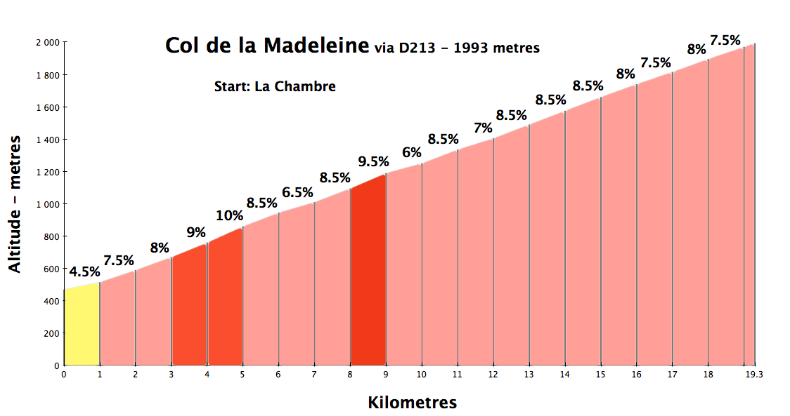
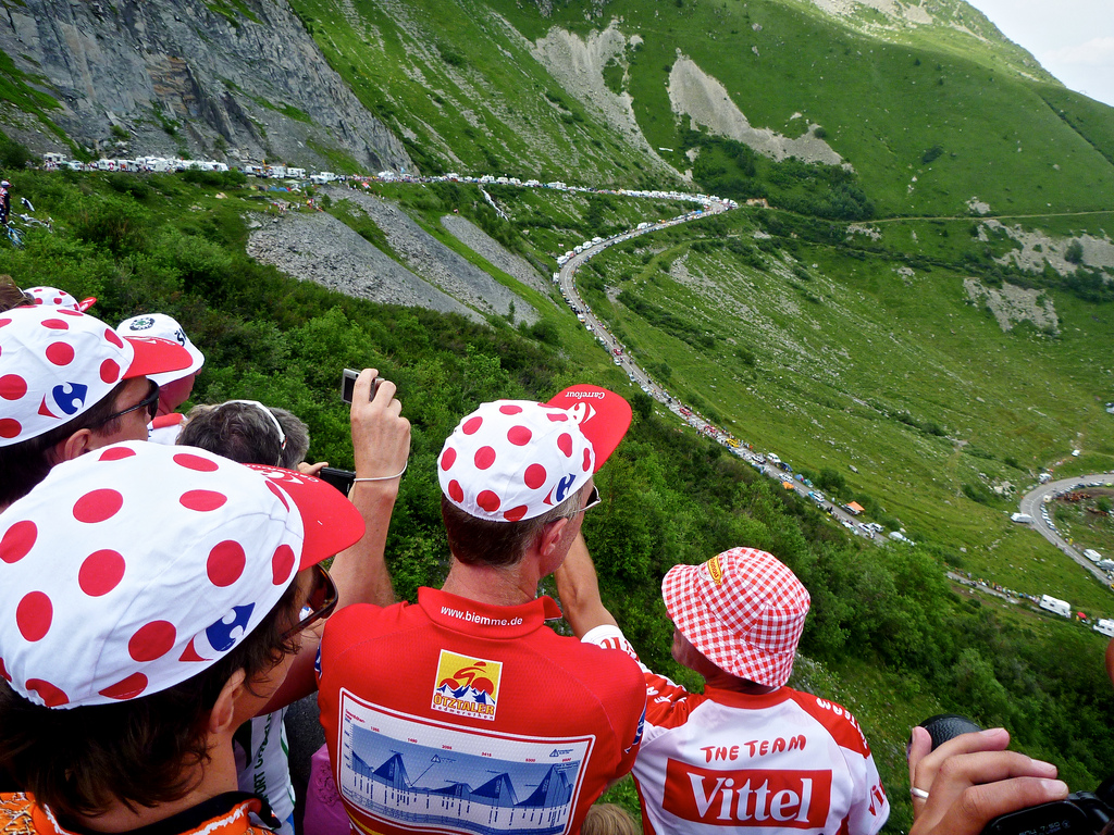
The classic south side starts in La Chambre and climbs the D213. Only 19.5 kilometres, this side is relentless with approximately 40 hairpins. Three kilometres from the summit is the ski station of Saint-François-Longchamp. The final stretch of the climb winds up the ski slopes.
Col de la Madeleine has appeared in the Tour de France 25 times. Always climbing one of the two above routes – D213. In Daniel Friebe’s Mountain High he talks about David Millar’s lonely battle with Madeleine in 2010, 35 minutes behind the peloton, desperately and ultimately successfully finishing ahead of the cut-off time. I had the good fortune to be on the mountain that day.


A Quieter South Side
The orange route on the map

Also starting in La Chambre, there is a another possibility by road bike via Montgellafrey. Basically, this climbs the other side of the gorge across from the D213. It is much quieter, equally tough, eventually rejoining the D213 at St-François-Longchamp, sharing the final 3 kilometres to the summit.

Note, in this link, I climb this route and also add a little detour to Lac de la Grand Léchère.
The Fourth, Best Way
The green route on the map
This is the route I keep revisiting. Magnificent.

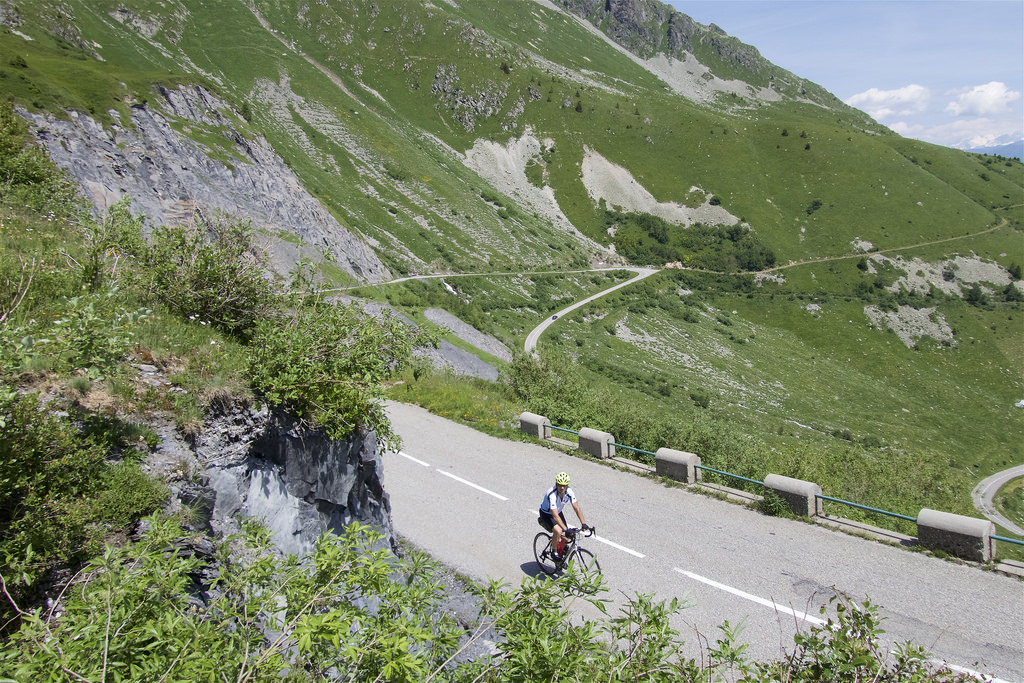
In 2015, Les Lacets (hairpins) de Montvernier made its Tour de France debut, revealing this great “secret” road to the unwashed masses. It’s a beautiful series of 17 hairpins, but – a warning – it’s perhaps only 20% of the way up the challenging Col du Chaussy – a great climb in its own right. After reaching Col du Chaussy the route briefly descends then turns onto a road that turns up to Lac de Loup. It soon becomes unpaved, eventually crossing a ridge into the valley with Madeleine, descending a ski-station-service road above St-François-Longchamp to rejoin the top of the south paved D213. This unpaved stretch is super-scenic, and super-quiet.
It is possible to get from Col du Chaussy to the Madeleine route on a paved road, but it joins the D213 quite far down. Still, I’ve added the paved link road to the map (dark blue).
More details of this option here or here with lots of photos of Les Lacets de Monvernier.


Edit: Here’s one of my better videos taken years later of this 4th option:
Final Thoughts
Al four of the above climbs are worth a visit, but I especially recommend the unpaved route that includes Les Lacets and Col du Chaussy. I promise it will be a day you won’t forget. And remember, don’t believe everything you read: the new monument at the summit of Madeleine (like the col signs it replaced) claims that it is at 2000 metres. It’s actually 1993 metres.

13 Comments
Will,
Thanks for details of the 4th route – a great and unique ride. I started in Meribel and climbed the north side which I always love. After the obligatory tarte tartin and coffee at the top I descended to La Chambre in search of the Lacets and Chaussy. I was more concerned about the off road after Chaussy and after the long north ascent of the Madeleine I had rather dismissed this as a relatively short climb. I found Chaussy surprisingly tough especially in the heat but it was beautiful and I only saw one car and two bikes during the whole climb.
The only difficult navigation was finding the right hand turn to Loup during the Chaussy descent as you’re going quite fast at this stage. I was worried that the off-road track would be difficult to find but it was easier than I thought and there is only one option most of the way. I saw a few walkers who gave me strange looks when they saw I was on my road/cross bike. The uphill was fine and the descents interesting on a road bike with 28s but certainly rideable. It also had the advantage of making the last 2K of the south side seem easy when I got back on a paved road again.
Thanks again – would never have even thought of this or found it without your excellent site.
Nick
Nick, Great, well done, thx for the comment.
How long is the unsaved portion?
Hi Eric, perhaps 12 kms. The last few are the roughest as you descend into the Madeleine valley. I usually do it with 35c tires. I know people that have done it on road bikes, but you need to be quite unfussy.
Thanks a ton for the detail. 12km is a decent distance. We have laclets and madeleine from st jean on our Initial route. Love the idea of the gravel adventure. If we put 28s on will that work? Also, is there a good way to connect the two without the gravel that you like? And lastly, my current route has us going up near Albertville before headed back southweat on d925 which I remember as flat and a bit boring. Thank for any guidance!
Hi Eric,
Generally, the gravel stretch is good quality and you are climbing so tires are no big deal. It’s just the last 2 kms or so over the top into the madeleine valley that are rougher and downhill. But if you are not too fussy then 28c are certainly possible. I have received messages from people that have crossed with road tires. It’s a question of attitude.
Separately, you can climb les Lacets de Monvernier and then Col du Chaussy and still climb Madeleine all on main roads, BUT the descent of Chaussy take you quite far down and joins the madeleine main route quite low, But very do-able.
Pingback: Col de la Madeleine and Le Logis des Fées
Does the D76 by Montgellafrey have the same white and yellow km markers as the D213? Thanks.
Hi, sorry I am not certain. But a very nice way up.
Will thank you for all the amazing Info. This is day 5 in the Alps. I have used your site to plan everyday. And will continue to do so for the rest of my trip. A amazing wealth of knowledge. And I love the fact you have so much info on gravel. I did lacets to chaussy to lac loop to Madeline today on 25c was awesome. Last downhill stretch is actually in quite good shape. Packed dirt for t he most part. Thanks again you rock
Wayne burnzee /strava handle.
Really sorry to hear about your crash. You sound like you are in good spirits. Sending healing vibes your way. Pls get well soon.
Excellent, it’s an amazing route, well done
Hi Will. We are making plans for our 2020 trip from NZ and Col de la Madeleine is on the list. I love the sound of the fourth route but we will be on road bikes with 25’s or 28’s on. We will also ride Lacets de Montvernier that day. Given that, what route would be your pick? If from the North, we would probably just do LdM first and drive around from there.
Your other route option: Climb Les Lacets …. continue up to Col du Chaussy. Descend the far side on the D99 (fully paved). It descends quite a long way and then joins the D213 – the main road up Madeleine.
Remember the south side of Madeleine has two paved options: the D213 and the far quieter D76. Whichever side you climb, descend the other.
If you take the Cjaussy option: 1) it’s a big day, two when you finally descend Madeleine to La Chambre, you can traverse in the valley back to the base of Les Lacets. Quite a busy road, but fine on bike.