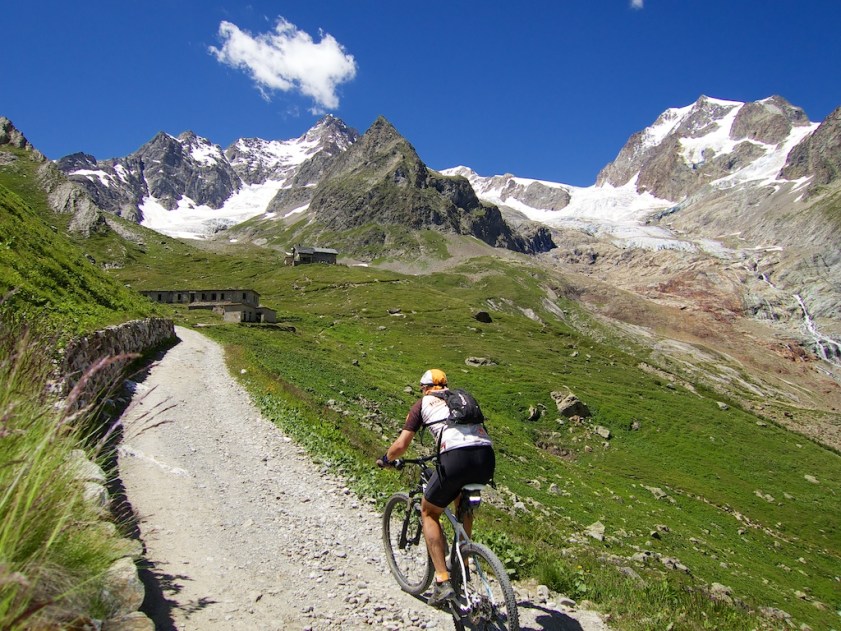
I started near Courmayeur, just below the Mont-Blanc tunnel. The entrance to the valley can be difficult to find. Just look for Val Vény signs – there is only one road in.

The beginning is paved, and occasionally steep. But after several kilometres the road is closed to cars. Nice! It is paved for a while, then becomes a good quality gravel road.
After a long, steep stretch, I reached Lago di Combal. The road flattens out and traverses a long marsh. A false flat, with views of the challenges ahead.

While uncertain, the name Col de le Seigne may come from the old Celtic word sange meaning marsh. Which makes sense given the boggy fields in the two flat stretches.

After some hard climbing, the route enters another long, flat valley which I think is called Vallée de la Lex Blanche (at least in French). A view from the far end:

After crossing this valley, Col de la Seigne is not too far away. But here the road ends, and the hiking trail higher is often far too steep to ride. No worries, it’s a nice place to carry a bike.
The Col is at 2512 metres and is the Italian/French border. Over the other side, it is not far to the Ville des Glaciers, a side road off the route des Grandes Alpes – a few kilometres below Cormet de Roselend on its south side.


All the tables at the refuge were full except mine and a group of very fit Japanese seniors who asked if they could join me. A couple of beers later, they decided they liked me, and I must be in at least 50 of their vacation photos. 🙂 A fun ending to a very fun ride.
A beautiful ride under high mountains and glaciers. It's quiet, but the early stretches does have more tourists than usual for a high alps mountain bike ride.
-
Views
-
Difficulty
-
Quiet / No Traffic
-
Fun Factor


1 Comment
Pingback: Col des Chavannes