Col du Joly is one of my favourite road bike climbs starting from Beaufort – details here. Last time I climbed it I saw a mountain biker summit from the other, east side, which surprised me. I made my usual mental note. Finally, today, I gave this east side a try.

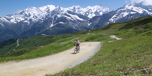
Starting in Les Contamines, after a couple of kms the route heads up and becomes unpaved. It’s extremely steep at times, winding up a ski slope.
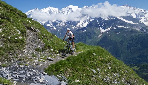
The entire ride is dominated by the Mont Blanc Massif, as well as other mountains. It’s an amazing place. The higher the better for views.
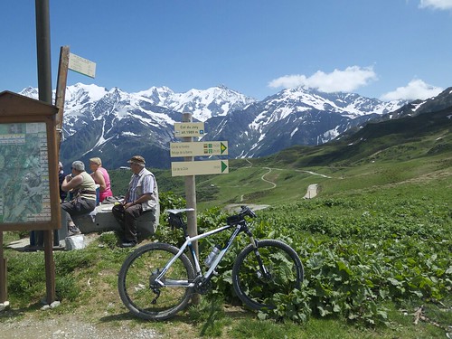
After reaching the Col, I noticed a road heading higher that looked ride-able – so off I went.
I passed a 1914 memorial to two people that died here:
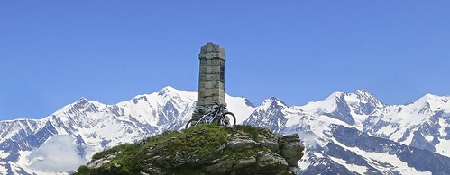
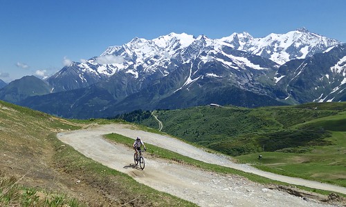
The road was wet from melting snow, and steep …. and I had a (friendly) German tourist chasing me. But I beat him to the top (roughly 2250 metres) and took his photo:
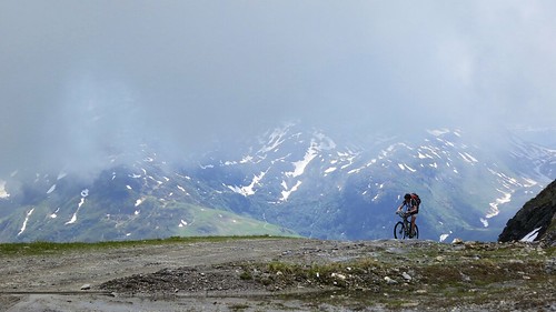
It seemed possible to go higher, but the “roads” were covered with snow. So instead I followed a mountain bike sign that I thought would head down.
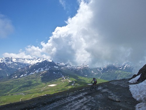
Here I made a mistake. I should have descended the easy-to-see road from Col du Joly. My mountain bike route stayed high on a single track. Much of it had been eroded by avalanches, and many of the torrents/rivers were covered in snow and mud and were tricky to cross. But it was fun at times:
Then the mountain bike signs disappeared. I was enjoying myself, but couldn’t quite figure out how to get down. Finally I found a hiking trail and walked half way down until I finally found a road.
All in all, a truly stunning route, but again, I’ll take the more direct way down.
Col du Joly is one of my favourite road bike climbs starting from Beaufort. But this mountain bike route climbs the from the other, east side. Fantastic trails in the shadows of Europe's highest mountain.
-
Views
-
Difficulty
-
Quiet / No Traffic
-
Fun Factor
5 Comments
Another great ride, thanks for sharing. I went over Col de Joly from the north on my cyclocross bike last year with lightweight touring and camping gear. I left Les Contamines in the same place as you, but after Les Crets I stayed lower down in the valley, basically in between your two routes marked on the map. This was generally a pretty good gravel road, and I rode almost the whole thing with my 28mm front & 32mm rear tyres, maybe having to walk just a couple of times when the gradient got above 20%, but it was more often only 10% and rideable (albeit slowly) for me.
Having the ‘cross bike was ideal, because I then continued quickly down the paved road on the south side, then through Beaufort and onto the second gravel pass of the day, Cormet d’Araches, before ending up in Bourg St Maurice. Having started that day just north of Sallanches, it was certainly an ideal route for the genre within a genre of ‘cross-bike-Alpine-touring.
Chris,
Yes, that “middle” road that you took is how I should have descended. Your route is an excellent one.
I’ve been up Cormet d’Arèches but yet to descend the other side yet. One day I’ll loop it with Cormet de Roselend.
Pingback: My Top Ten Routes / Photos for 2013 : Cycling Challenge
Pingback: 2014 “Cycling the Alps” Calendars : Cycling Challenge
Pingback: Aguille Croche via Col du Joly