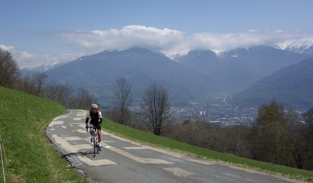
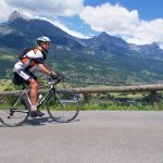
Stage 19 of the 2016 Tour de France is a tough north French Alps mountain stage. But it visits some lesser known climbs that people might not be familiar with. So I thought I’d post a route preview.

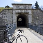
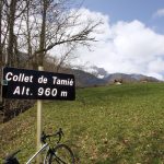
Let’s get right to it: Starting in Albertville the route immediately climbs, heading up to Collet de Tamié at 960 metres. Note, this is the NOT Col de Tamié (907 metres). It is just above, on a smaller road, beside the Fort de Tamié, an old Savoyard stone fort built in the 1870s that overlooks Albertville and the valley below.
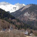
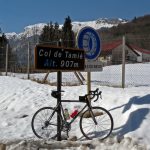
Just after the Collet, the route briefly descends, then join the main road, passing Col de Tamié. The descent will then pass the Abbaye Notre-Dame de Tamié – famous for its cheese. It’s a simple descent, not steep or technical as the peloton speeds north towards Lake Annecy.
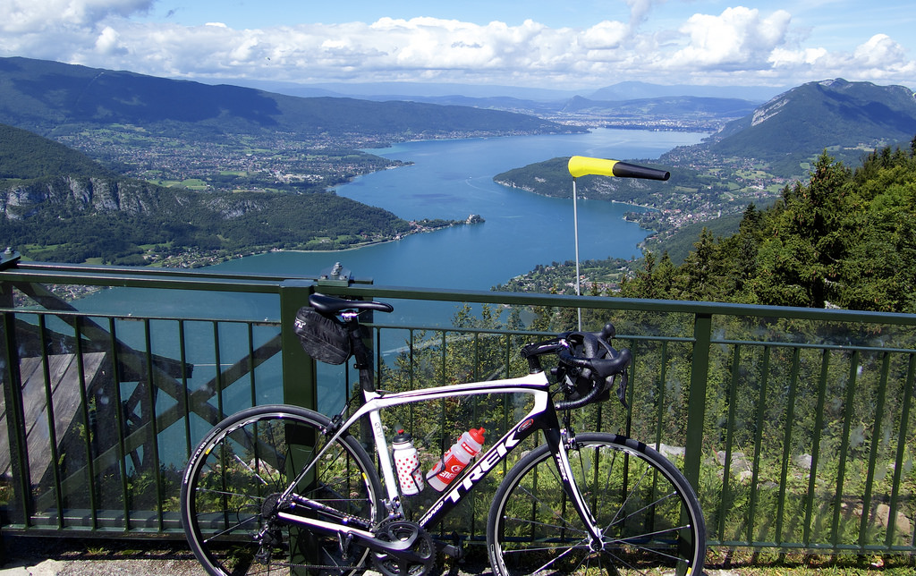
The route reaches the south tip of lake Annecy and will ride along the east bank briefly before heading up the steep and scenic climb to Col de la Forclaz de Montmin.
What Does Forclaz Mean? There are three Col de la Forclaz in the 2016 Tour – two in this stage. Forclaz is old dialect in the north French Alps meaning “Narrow Gap.” I think I’ve cycled 6 cols with this name, and there are several others without roads in the high mountains. The Swiss Col de la Forclaz in stage 18 and the Forclaz de Montmin (see below) are the two best on a road bike.
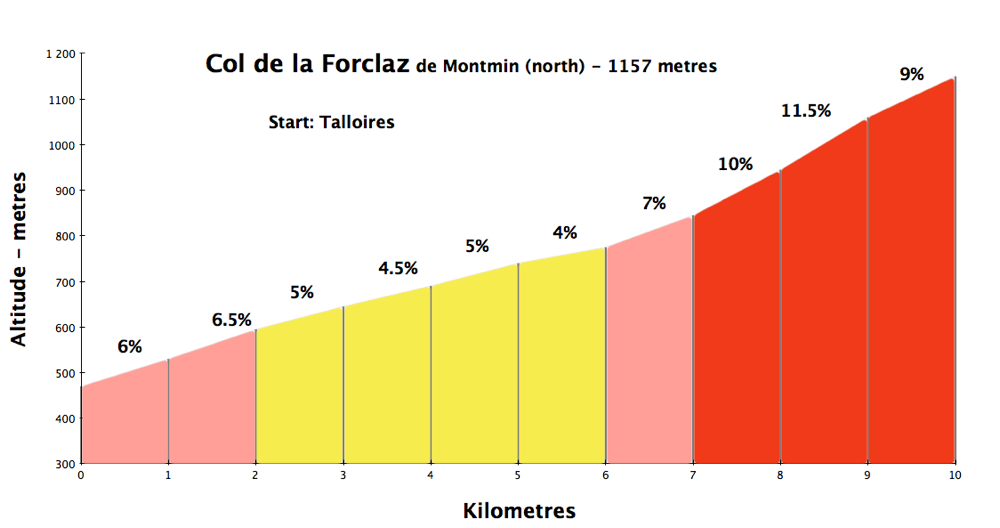
This is a great climb, with nice lake views throughout, and three very steep final kilometres. Either side is good, but for cyclotourists, I recommend the steeper, quieter, south side. The best Annecy lake loop is to take the bike path along the west side of the lake, then climb Forclaz from the south. Details here. This was the first mountain I ever watched a Tour stage – 2004 – Virenque first over the top (in opposite direction).

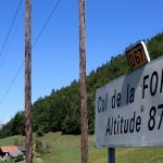
After a fairly hair-raising descent the route heads through the valley towards Albertville. But near Ugine, it takes a small road up to Col de la Forclaz de Queige. This is the least interesting of the three Forclaz in the Tour, but it is still category two with 5.6 kms at 7.8%.
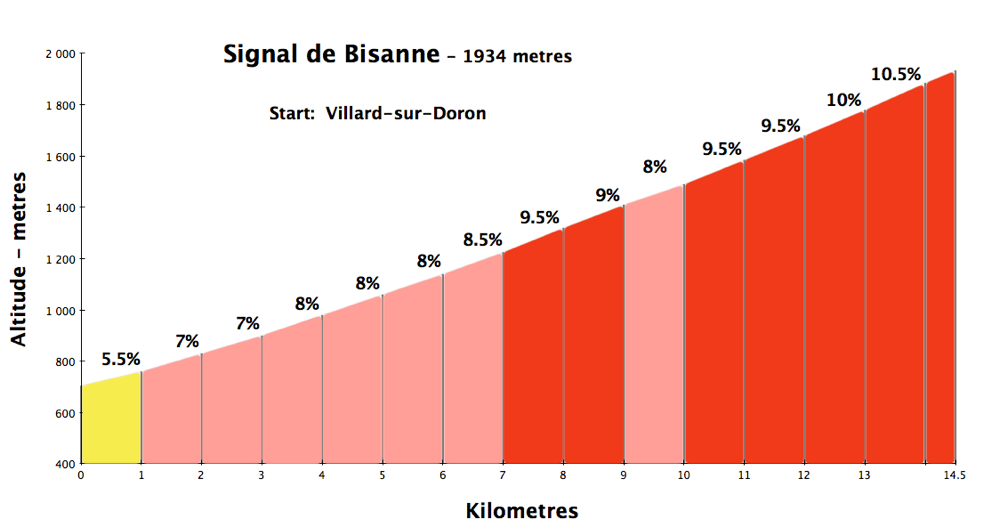
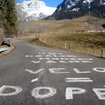
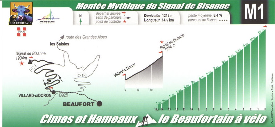
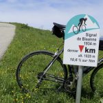
After a brief descent the route soon begins climbing perhaps the most interesting “unknown” climb of the entire Tour de France: the Montée de Bisanne (1723 metres). This climb is actually called Signal de Bisanne. This dead-end road goes to 1934 metres above Saisies ski station, but the Tour used the Montée name vs Signal as it will skip the last 2 steep kilometres. This is a quiet monster of a climb.
The profile above includes the entire climb to Signal de Bisanne. Again, the Tour will skip the last 2 kms or so. But I have faith that you want to climb the entire road.
Nice hairpins:

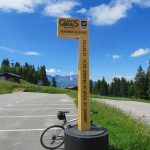
Mythic. The Beaufort region tourist office used to give out route cards for their 20 signed cycling routes (they probably still do). Of these 20, only 2 were labeled “Mythic” – not even the Cormet de Roselend merits a “Mythic.”
After la Montée de Bisanne the route will pass through Saisies ski station, descend through Megève, and descend the Domancy route that was climbed yesterday – Route Bernard Hinault.
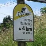
After reaching the bottom of the Domancy climb, after a brief flat stretch, the route turns right onto a tiny, slightly crazy road, as the final climb to Le Bettex begins.
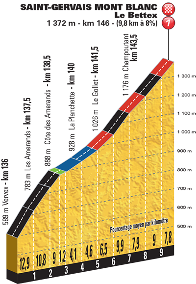

The profile calls the first kilometre 12.9%, even as it begins flattish. It’s tough to photograph steepness, but trust me, this ramp must be at least 16% at times.

After 2 kilometres, the route leaves this tiny road and joins a bigger road heading to Le Bettex. It gets easier for a while, and the crazy stuff is over, but the final four kilometres still have plenty of climb. It’s an interesting road to end a Tour stage, but not that interesting a road for cyclotourists. For the more adventurous, a small unpaved road continues from Le Bettex much higher to Col du Christ – see here.
Le Bettex is a small ski station at the base of ski lifts part the St. Gervais/Megève ski domaine.

Final Thoughts
This is a fun, challenging stage visiting some lesser known climbs in the region. In particular, the Signal de Bisanne is fantastic and in the heart of the Beaufortain region – a cycling Mecca. But as I wrote in my stage 18 Megève Time Trial Preview, the region around Le Bettex is lousy for road biking. In fact, even the great, steep, tiny road that begins the final climb is used as a shortcut by drivers.
Let me cut and paste exactly what I wrote previously:
Let me be frank: This is an absolutely lousy region for road cycling. And I’d include the entire valley up towards and past Chamonix. There are just too few paved roads, and they are busy. I cycled Le Bettex and the Megève TT route, and the Côte de Domancy is indeed fun, and the upper climb cleverly uses some quieter roads, but try constructing a long ride without traffic here – not easy. This beautiful region is for hiking, skiing, mountain climbing. Leave the road bike at home.
But here are a few very good mountain bike climb ideas:
- Aguille Croche via Col du Joly – super high, super scenic.
- Col de Véry via Col de Bassecombe – starts in Megève.
- Col du Jaillet – across from Megève.
- Col du Christ – above the Megève ski slopes
- Plaine Joux – (road bike) scenic views of Mont Blanc

1 Comment
whata shame they couldn’t have thrown in Arpettaz as review by you recently. A brilliant climb.