Why bring a gravel bike on a great paved climb? Because sometimes the real fun starts when the paved road ends. But if you only road bike keep reading: this post includes a very worthwhile climb for you.

My simple route planning strategy: pull out a map of the Val d’Aosta region and look for a cluster of unfamous hairpins. I knew the road to Druges (1588 metres) was paved but I didn’t know the route beyond. So I rode some wider tires to maintain flexibility.
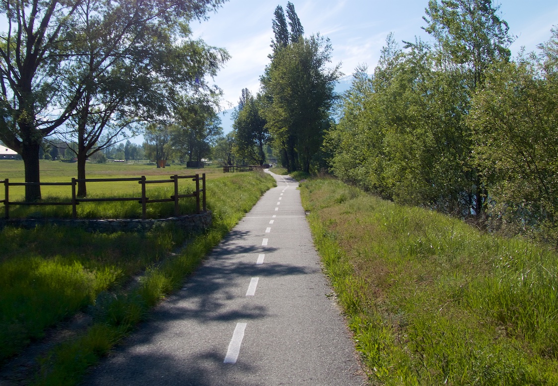
But I am getting ahead of myself. Note the elevation profile in the map below. The first and last 15 kilometres of this route are flat, on a dedicated bike path well away from roads. It runs along the Doria Baltea river, a branch of the Po running through the main Aosta valley. In a region where the lower roads are often quite crowded, this is a great find:
I was heading to the start of the paved climb and ran into a closed road, so I took a higher traverse road.
Warning, just before the start of kilometre 24, I made a 1 kilometre traverse on a fairly wild unpaved cliff road. A road bike could easily bypass this by taking the hairpins below.
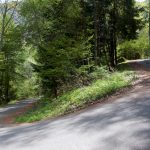
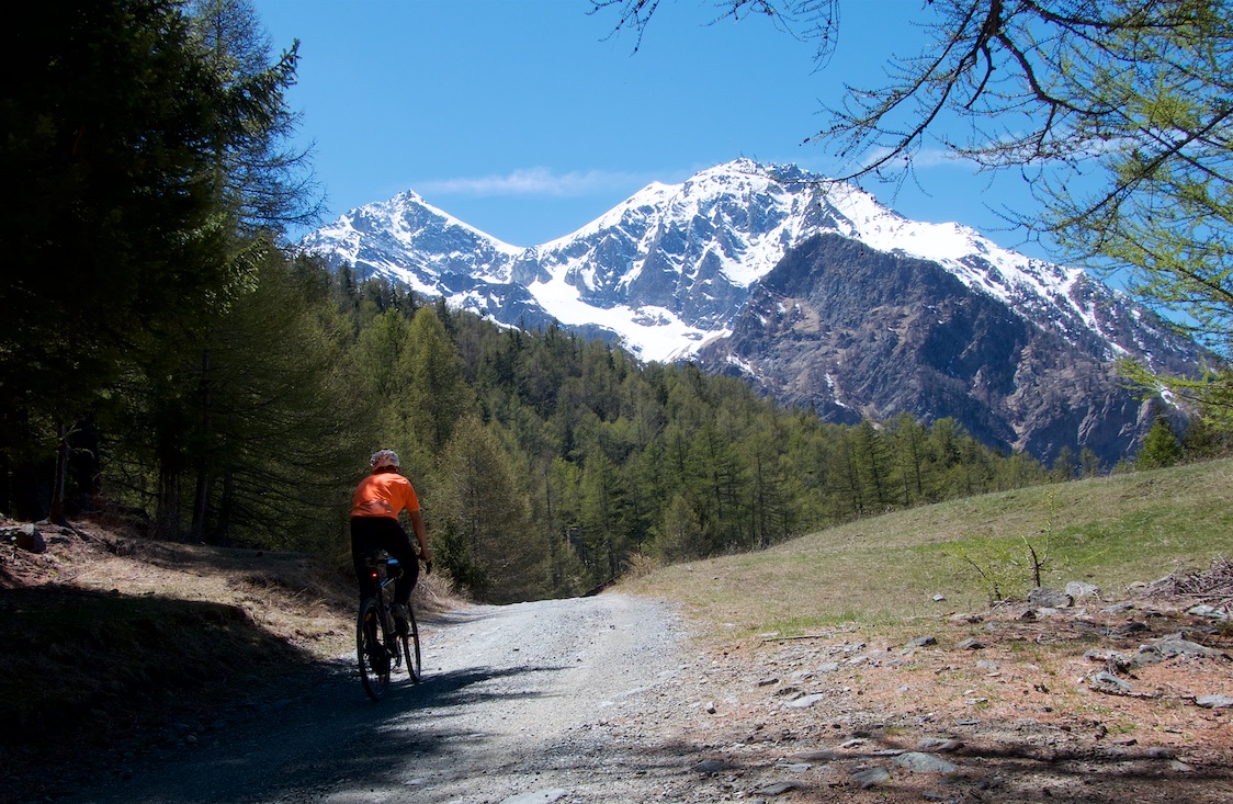
The profile is only for the paved climb. It’s steep, hairpinning up through a forest. Very quiet, I never saw a car. The summit is a tiny village with a ski slope.

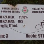
There are small cycling kilometre signs along the way

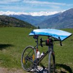
Plenty of mountains views throughout, especially higher up as the forest thins:

The descent from Druges shown on the map is also paved. But the entire there/back extension above Druges follows a dirt/gravel road. All the way to Lago Layet (2273 metres). . Woohoo!
See here for a map detailing more paved and unpaved climbs in Aosta and Piemonte, Italy
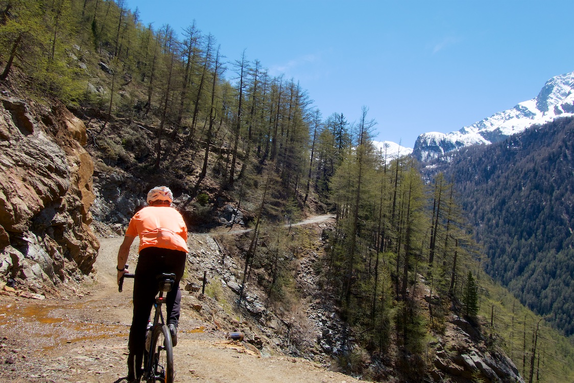
From here on I had no idea what to expect. But early views were promising:

The route curved around a big mountain along a fairly amazing cliff stretch before entering a “secret” high alpine valley.


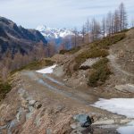
The road was crazy steep and slippery at times, but mostly rideable.

I reached the end of a three-sided amphitheatre valley and the snow line. But my map showed the road weaving higher up to an Alipine lake. I LOVE ALPINE LAKES. So I kept going. But I decided to leave my bike at roughly 2050 metres as the snow got heavier. I hadn’t seen a person since the gravel started so I didn’t hide my bike.

My plan was to keep going as long as it seemed safe. Occasionally the road would reappear with little snow, and occasionally I’d be sinking the length of my legs. I would have turned around a few times but there was a set of old tracks. In fact two. An intrepid hiker had brought his dog. So I followed them. The occasional screech of a startled marmotte (not used to humans for several months) made me jump, but they were always too quick for a photo. .
It took some time to do the final kilometre and a half, but in summer I think it would be mostly rideable (some parts are crazy steep). A few photos:


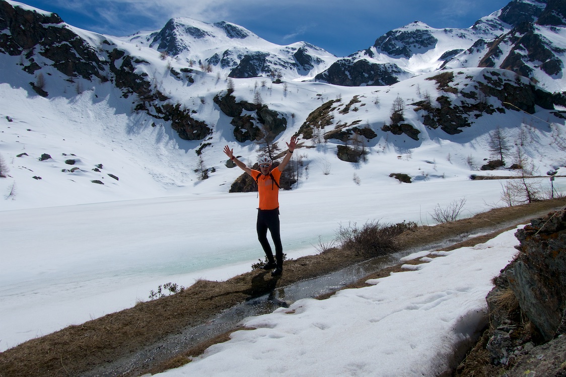
Success. Lago Layet (2273 metres):
My feet were soaked and quite cold. So I got a move on hiking back to my bike. If you look closely at my gps track you’ll see where I initially went right by it missing that stretch of the road. Oops.
There is a well marked alternate unpaved route down a few kilometres along the way back, but the gorge it went through looked crazy steep and I worried I’d be walking a long way, so I just headed towards Druges.

The descent of the western paved side from Druges is rougher than the way I’d climbed but deserted. I took my time then rejoined the bike path for a scenic, car-free 15 kilometres back to the start:

This was fun. I had initially planned to ride to Druges and then do a second small climb. But I just kept going, and it was an excellent decision. Maybe I’ll try and visit when all the snow is gone and see how much further once can go.
A Second Map
I’ve been having trouble on some of my old posts with maps no longer working as companies change their code. I’m trying to fix this, but may start posting 2 maps on future posts to future protect things.
6 Comments
I am a beginner in this bicycle riding and I am really discovering a fantastic world! Finding me with a blog like yours motivates me a lot and of course I thank people like you for doing this kind of thing, the truth is great! very good pictures too. I send you a hug from Argentina!
Very nice! you always find someplace new to explore.
Just east of Druges you can climb into val Clavalité from Fenis/Miserègne. The road is paved to about 1500m, second half very steep (a lot of 11-13%). Where the road ends the valley flattens and there is a small dam lake and restored farmhouses. Full frontal views of the Cervino/Matterhorn across the valley. An unpaved road contiues above but I have not been up there.
Hi Thomas – you wouldn’t have a gps lnk to that route? – I’m over in les Gets heading back to Milan in a few weeks time with my Gravel bike – this sounds like an ideal side trip.
Regards
Richard (New Zealand)
thanks for the tip
So, as per you suggestion I looked into the voie verte along the Dora Baltea. With our kids (almost 5 and almost 7) we started in Saint Marcel and cycled all the way to Saint Vincent, a good 20km. Nothing too hard for the kids to cycle apart from two stretches.
First, there were some road works just after we started, so we had to go up and over a small hiking trail with our bikes. This involved a bit of pushing the kids from my side, but nothing too heavy. Some nice off road riding after that though.
Also, we ended in Saint Vincent. There, I had to push the kids up some steep stretches to cover the 100m elevation difference into town.
I left the kids with my wife in Saint Vincent to enjoy some well-deserved drinks and food while I raced back to Saint Marcel to pick up the car. On the way back I ran into a few single track stretches straight after the Torrente Clavalité joins the Dorea Baltea (looking East to West right before the canal starts).
For more info, have a look here: https://www.strava.com/activities/3858721092
Thanks for the suggestion, GREAT!!
Excellent, well done