


I like this loop on a late winter day when it’s been sunny for a while – so the roads are fully ice free. It starts near Annecy following the Annecy bike path along the west side of the lake. Scenic and flat, so a good way to warm up.
A local fisherman was having fun too in the morning haze:

I followed the bike path all the way to Marlens (see bottom of post for a route map). Note, the bike path goes all the way to Albertville – see here.

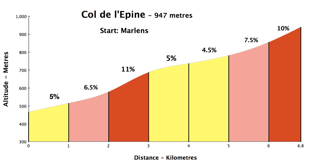
The village of Marlens is beside the bike path and is the beginning of the 7 kilometre climb to Col de l’Epine.
It’s a very quiet road, nice hairpins, and great views of the valley below and surrounding mountains.
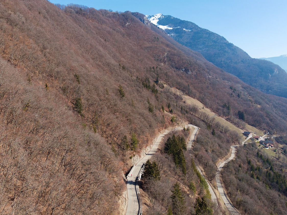

Don’t confuse this Col de l’Epine with another Savoyard Col de l’Epine of similar height on the shoulder of Mont du Chat. See the dark blue route here for details.
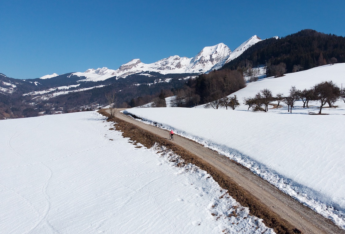
Exactly at Col de l’Epine is a gravel road that goes a little higher. The views looked great today so I took my road bike for a brief detour. I’ve done a fun unpaved multi-col ride high above here but in warmer weather – see here.
I descended Col de l’Epine through a great gorge passing Col des Esserieux (labeled on map).

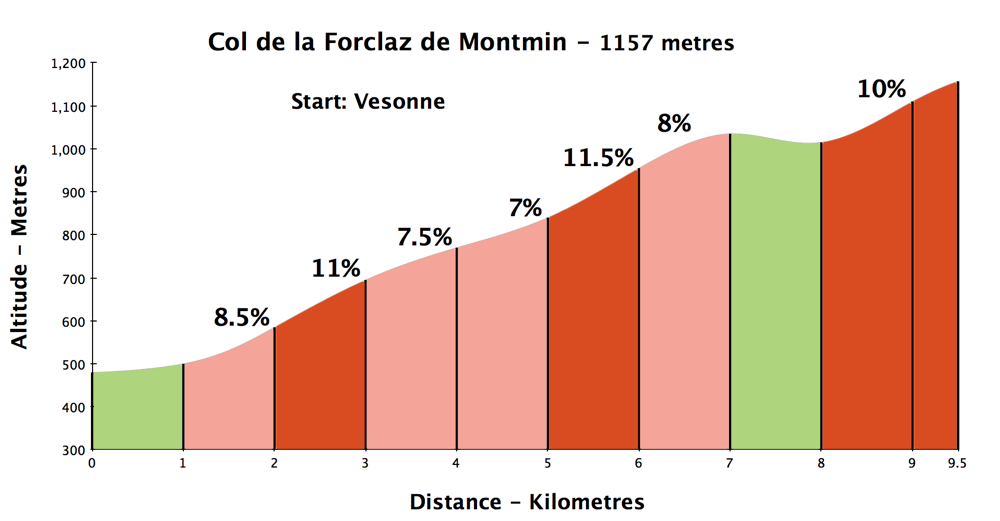

Next, I would climb Col de la Forcaz de Montmin. This is a beast of a climb, even tougher than its profile suggests as there are a couple of flatter parts lowering the average grades. Lots of 12%-14% stretches.
The north side has views of the lake, but personally I prefer this scenic, quieter south side. I saw my 1st Tour de France mountain stage here in …… 2004!


The reward for a tough climb? A brilliant lake view at the Col. There is a restaurant here with a patio overlooking the view – perfect in summer.

View descending the north side of Col de la Forclaz:
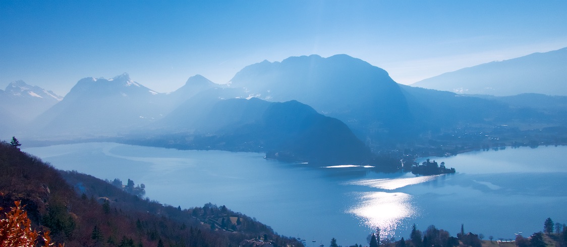
After descending the north side of Forclaz, there is a new separated bike path – it gets longer every year. But soon the path ends and the route joins a busier road. See the map: I jumped down onto smaller roads to avoid this for a couple of kilometres (could have done it sooner) but happily another bike path appears at the upper east side of the lake, and it continues all the way back to the start. Brilliant.

This is a great loop with two fun climbs. It’s not too high and thus allows some early season Alps riding. One could easily do a loop with only one of these cols, or add more climbs. For example, I once rode this same loop but added Col de Tamié – see here.
See this old post: The Ten Best Cycling Climbs from Lake Annecy for more ideas (I’ll hopefully update this soon with some great high-gravel stuff from recent years).

A 3D video of the route:

Bridge on Col de l’Epine:


6 Comments
Wonderful, I am now insanely jealous. I am also glad you described the Col de la Forclaz as a beast. I tried this after successfully riding Semnoz a few days before and thought I’d be okay. I had had a late night, too much vin rouge and set off all cocky. Within a few km I gave up and rode back to Saint-Jorioz with my tail between my legs! Those early gradients were too much for me at the time. I will return one day!
Hi Will,
Thanks for your excellent posts and superb pictures! I am not sure I share your definition of fun (La Forclaz? From Vesonne? Fun, really?), but I agree this is a beautiful and quiet ride.
I was curious about col de l’Épine, which I climb from time to time: are you sure about the grades you give: I haven’t done any measurement, but it does not feel like there are stretches at 11%. And the last kilometer is actually quite a relief, rather than a 10% climb. Just my personal feeling (backed by the signs on the side of the road).
Anyway, thanks again for sharing all these rides!
Hi Vincent. Maybe, I see your point. But the math works. In other words the ascent percentages plus the starting altitude equal the summit altitude. So if the final 10% is too steep then the previous kms are perhaps a touch steeper. I can’t remember where I got the data from as the climb is not in my usual book. Perhaps from my GPS. I’ll have a closer look.
Hi Will
I did this route two days ago, after seeing it on your website, and it is BEAUTIFUL. I loved Col de l’Epine and the few kilometres after the Col. Beautiful. Oh yeah, I already said that 😉
I noticed just after Col de l’Epine that there was a right-hand turn for Route de Mont Charvin so today I’m going to explore that option.
But wow – Col de la Forclaz via Montmin was tough (although I agree, it is calmer and preferable somehow to the climb via the other side). What a relief it was to get to the flat-sh part about 3km before the top, where I was able to regather my thoughts for the last bit of the climb. And how cruel it is that as you round the last corner there is a sign that at first appears to indicate you have reached the top, but alas you actually have a little more climbing to do.
Your photos with the drone are stunning.
Thanks again for all the info on your site – it’s such a great source of inspiration.
Melanie
Hi Melanie. Well done. Yes, Forclaz from the south is very steep, but quiet and beautiful. Easily my favourite side. See this post where I took that turn towards Mont Charvin: https://www.cycling-challenge.com/mont-charvin/
Thanks Will – I looked at the link you sent – I was on my road bike today, so I only followed the Mt Charvin road as far as it was paved, which I think might be where you turned off to do Col de Fer/Sur le Feu. Yours looked like a great loop to do.
I was overtaken on Col de l’Epine by a very friendly cyclist who I am sure was about 75 and who then disappeared into the distance. I looked but his bike definitely wasn’t electric! Humbling.