
Are you looking for a challenging cycle touring route in the Alps that visits some of the most famous Tour de France climbs?
The Route des Grandes Alpes starts on the shores of Lake Geneva and crosses 16 of the highest French passes continuing all the way to the Mediterranean Sea. Over 700 kilometres (+400 miles) and almost 15,700 metres (51,500 feet) of vertical climb.
The official website in multiple languages is here.
This stunning route includes:
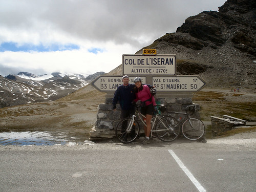
- The Highest Pass in France – Col de l’Iseran @ 2,770 metres (9,090 feet)
- The Longest Climb in France -Col de l’Iseran @ 47.5 kilometres (almost 30 miles)
- The Highest paved road in France – Cimes de la Bonette @ 2,802 metres (9,190 feet)
- The Biggest Vertical Climb in France – Col du Galibier via Telegraphe 2,120 metres (7,000 feet)
- A detour to the base of Alpe d’Huez
The 2008 Tour d’Enfer*

This summer I will ride a week long cycling tour broadly following the Route des Grande Alpes. A trip organized by my friend Leslie that will include people from the USA, Canada, France, Turkey, Germany, and Switzerland.
Our Tour has two main deviations from the official route.
First: On day one we will skip the first 30 or so kilometres from Thones and instead start in Morzine. This avoids a relatively busy boring stretch. We will then do a long-cut around the minor and uninteresting Col des Gets (1,170 metres)and climb the legendary Col de Joux Plane (1,691 metres) – a frequent Tour de France climb in recent years including the miracle Landis day in 2006. Near Taninges, we will rejoin the official route.
Second, we will finish the tour in Barcelonnette. Instead of reaching the Mediterranean, we will spend three days cycling in one of the best locations in France for beautiful climbs. See Barcelonnette – Cycling Paradise for more.
Here are detailed stage descriptions with maps and photos of the upcoming July 2008 Lost Boys Tour d’Enfer.
Day One – Morzine to La Cluses
- 76 kilometres (47 miles); Ascent: 2,400 metres (7,875 feet)
- Col de Joux Plane and Col de la Colombiere
Day Two – La Cluses to Bourg St-Maurice
- 92 kilometres (57 miles); Ascent: 3,030 metres (9,940 feet)
- Col des Aravis, Col des Saisies and Cormet de Roselend
Day Three – Bourg St-Maurice to Lanslebourg
- 80 kilometres (50 miles); Ascent: 2,100 metres (6,890 feet)
- Col de l’Iseran
Day Four – optional day – Watching the Tour de France on Galibier or Alpe d’Huez
- See Preview for link for distance/elevation options
- Col du Lautaret, Col du Galibier – (south side), and possibly Alpe d’Huez
Day Five – St Michelle-en-Maurienne to Briancon
- 71 kilometres (44 miles); Ascent: 2,120 metres (6,950 feet)
- Col du Télégraphe and Col du Galibier – (north side)
Day Six – Briancon to Barcelonnette
- 97 kilometres (60 miles); Ascent: 2,500 metres (8,200 feet)
- Col de Vars and Col d’Izoard
Days Seven, Eight and Nine – Barcelonnette
- See Link for Climbs Options
- Col de la Bonette, Col d’Allos, Col de la Cayolle, Sainte Anne la Condamine, Col de Vars (south side), Col St Jean, Col de Pontis, etc.
View in Google Earth (requires Google Earth – free)
*Tour of Hell
6 Comments
That is so great… I’m going to have to retire early so I can ride this route some day when I’m still in decent shape. Unfotunately, I’m just going to miss Leslie this weekend here in the states. He’ll be in Virginia and I’ll be over in the mountains of Western NC… we were so close to getting together for a training ride.
That is so great… I’m going to have to retire early so I can ride this route some day when I’m still in decent shape. Unfortunately, I’m just going to miss Leslie this weekend here in the states. He’ll be in Virginia and I’ll be over in the mountains of Western NC… we were so close to getting together for a training ride.
Pingback: Shhh! Martin Bought a New Bike : Cycling Challenge
Pingback: Beaufort: Five Great Cycling Climbs in Cheese Country : Cycling Challenge
Hi,
anyone doing the route des grandes alpes july or aug 2010?
I’ve done it in september 2012. It was an amazing experience!