
Tucked into the mountains of Savoie, not too far from Mont Blanc, is the beautiful village of Beaufort. Famous for its eponymous cheese, Beaufort also is a mecca for cyclists that like going uphill on beautiful roads. And readers of this site know I love Alpine dams/lakes, and there are four here worth visiting.
The region around Beaufort is known as the Beaufortain. Below, first I’ll provide details for the best road bike climbs, then discuss some truly exceptional mountain bike options. This will be a long post. I’ll try and keep the ride summaries brief but each includes a link with more details, maps, photos, profiles, etc. Every route discussed here is on the zoomable map below. I’ll refer to each ride by the colour of the track on the map.
Note, on the map I have also marked a few nearby cols that are not discussed in this article. But click the icons on the and there should be a link to more details.
1. The Route des Grandes Alpes
Col des Saisies and Cormet de Roselend
The 684 kilometre Route des Grandes Alpes – linking Lac Léman (Lake Geneva) to the Mediterranean Sea goes right through Beaufort. It is the blue route on the map. To the north of Beaufort it climbs and descends Col des Saisies (1650m). To the south it climbs Cormet de Roselend (1968m; a favourite) and the beautiful Lac de Roselend.
See here for a detailed post on this stretch of the Route des Grandes Alpes with a few suggestions for better options. Note, the link includes links to posts on every stretch of the Route des Grandes Alpes.


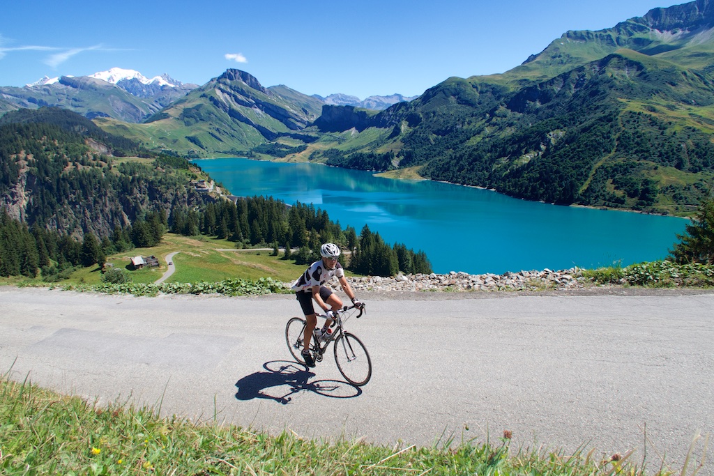
2. Cormet de Roselend via Col du Pré
However, the best way to climb Cormet de Roselend is not to take the route des Grandes Alpes, but instead climb via Col du Pré (1748m), the red route on the map. This alternate route is tougher – with some steep kilometres – but it provides truly fabulous views of the lake, and also allows you to ride over the dam – rejoining the Route des Grandes Alpes:
See here for details of Cormet de Roselend via Col du Pré.


3. Two Lake Detours near Roselend
While climbing to Cormet de Roselend from Beaufort via Col du Pré, following the black route on the map, one can reach Lac/Dam de Saint Guérin. Very pretty. Note, above the dam the road soon becomes unpaved – I’ll discuss this later. See here for a ride that includes Lac de St. Guérin and Cormet de Roselend:

Separately, just before reaching Lac de Roselend via the main road, the beige route on the map shows a short detour to Lac de la Gittaz. Trust me, +99% of cyclo-tourists ride on by, but it’s well worth braving a dark tunnel to see this lovely lake/dam.

4. Col du Joly
Dozens and dozens of climbs in the north Alps provide views of Mont Blanc. But I don’t think there is a paved climb that brings you as high and close as Col du Joly (1989m). The Orange route on the map to Joly from Beaufort is a dead-end (unpaved on far side, discussed later). It is quiet, and stunning with the highlight the arrival view. See here for a ride with Col du Joly and Col des Saisies.

5. Signal de Bisanne
In the 2016 Tour de France one of the tougher climbs was called Montée de Bisanne. It’s actually called Signal de Bisanne (the grey route on the map) but the Tour skipped the steepest final 2 kilometres to the “Signal”. Details here.

6. Col des Cyclotouristes
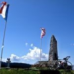
In 1967 a local farmer – Jean Poncet – joined two mountain forestry roads, one from Queige the other from Venthon creating this fantastic “Col.” Col des Cyclotouristes. Then, in 1969 during a rally, someone erected the Col des Cyclotouristes sign at the top. This sign was quickly removed by the Mayor of Venthon – because it’s not technically a geographic col (damn bureaucrats). But the sign was replaced during a winter storm – without anyone leaving foot prints! Finally, in 1992 the name Col des Cyclotouristes appeared on an IGN map. It was official. See here for details of the brown route on the map including Col des Cyclostouristes (1330m), Col de Montessuit (640m), and Col de la Forclaz de Queige (870m; appeared in 2016 TdF).
When I rode this route, the Google Maps car photo’d me, so if you use Google street view for this col you can find me. 🙂

Unpaved Rides
1. Cormet d’Arèches
Cormet is an old local word meaning col. And besides Roselend there is another nearby: Cormet d’Arèches (2107m). Like Roselend, this pass allows you to cross into the Tarentaise valley. But the top several kilometres of both sides are unpaved.
The North side is the black route on the map and climbs above Lac de St Guérin. Details here. But it is yellow route that climbs from the south that is particularly fun as there are gravel roads that head even higher to Col du Coin (2398m; some carrying at end), and Col du Couvercle (2295 metres) with terrific views of Lac de Roselend FAR below. Details here. Highly recommended.


2. Passage de la Charmette
Near Col du Pré, the dark red route is an unpaved farm road that leads to the Passage de la Charmette (2058 metres), and a trail that goes higher to Passage de Miraillet (2161m) – this gets close to Col du Couvercle – but unreachable due to cliffs, etc. Again, the views of Lac de Roselend are superb. I believe one could descend the far side of Charmette towards Lac de Guérin, but I’ve never tried. Ride details here including climbing the entire south side of Cormet de Roselend first.

3. Col du Joly and Aguille Croche
The purple route on the map is a truly great unpaved route up the far side of Col du Joly (1989m). Completely ride-able with nothing but views of the nearby Mont Blanc Massif. From Col du Joly there is an astonishing road much higher to Aguille Croche (2487m, the road reaches perhaps 2435m). One could of course climb Col du Joly from Beaufort with a mountain bike and head up to Aguille Croche.
Details here. And here is another Col du Joly unpaved ride, where I take a different way down.


4. Lac/Dam de la Girotte
On the way up the Beaufort side of Col du Joly (orange route) is a turn off to a great unpaved, hairpin-filled climb to the Lac/Dam de la Girotte – the pale green route on the map.
Here are details of Col du Joly from Beaufort including a detour to Lac de la Girotte.

5. Col de Véry via Col de Basse Combe
This is a beautiful three col loop starting from Megève on quiet, super-scenic old farm roads. Details here.

6. Beaufortain Col Hunting
The pink loop on the map passes 7 cols: Col des Saisies (1650m; via Crest), Col de la Lezette (1785m), Col de la Legette (1776m; descended) ;), Col de la Péchette (1948m), Col de Véry (1962m), Col Croix de Pierre (1970m), Col des Saisies (1650; via Hauteluce). Details here.

7. Bonus – A Hike
Exactly at the summit of Cormet de Roselend begins a truly fabulous hike – pale blue with hiking icon on the map. We did it in July and had to turn around before the summit as too much snow atop Col du Grand Fond (2671m) to chance without equipment. Truly Beautiful.

Final Thought
This is a truly beautiful region. But remember it is equally perfect for both road cycling and mountain biking. And the Beaufort cows that make the cheese? Also beautiful:

2 Comments
They look like fabulous climbs Will. I havnt done any of them yet. Plan is to knock some off before winter arrives although I am already looking at Sept due to schedule. Really want to do the Roselend especially. Thanks for taking the time to blog, I really enjoy them.
Thanks for the inspiration, I will definitely be checking these out next time I’m in the Beaufort. If you’re adventurous, you can do the Cormet d’Arêches on the road bike – I did it a couple of weeks ago from the Beaufort side (I would never recommend doing it from the Granier side as you’d be descending the worst part). It wasn’t always super fun but for a couple of km on the gravel with the road bike, it meant we could do a loop over Cormet de Roseland and back to the Aime area.